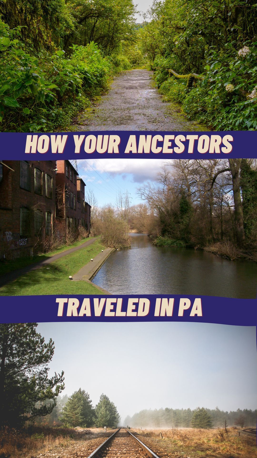
Ditch Your Car and Rediscover How Your Ancestors Traveled
Most genealogy research involves trying to find people as they moved from one place to another. Rarely are researchers lucky enough to have a family who lived on one property for several generations. Knowing how people traveled from one location to another is central to doing genealogy right.

Driving in cars has ruined the sense of what travel was like for our ancestors.
Most genealogy research involves trying to find people as they moved from one place to another. Rarely are researchers lucky enough to have a family who lived on one property for several generations. People moved around a lot!
Knowing how people traveled from one location to another is central to doing genealogy right.
To get you started on how your ancestors moved around Pennsylvania, here’s a brief history by time period with additional links and resources.
Travel Prior to 1820
For the first 150 years of Pennsylvania’s European settlements, the primary means of travel were the trails made by Lenape and Delaware people. These foot paths were the width of two people walking side-by-side. Maps showing these paths display back-and-forth dotted lines, looking like a confused wanderer. In reality, these paths are genius.
Pennsylvania’s hills and mountains which criss-cross the state are known for having springs in them. This bubbling water running down hillsides makes for unstable surfaces. Historians realized when reconstructing the indigenous foot paths that the paths were on dry and stable ground.
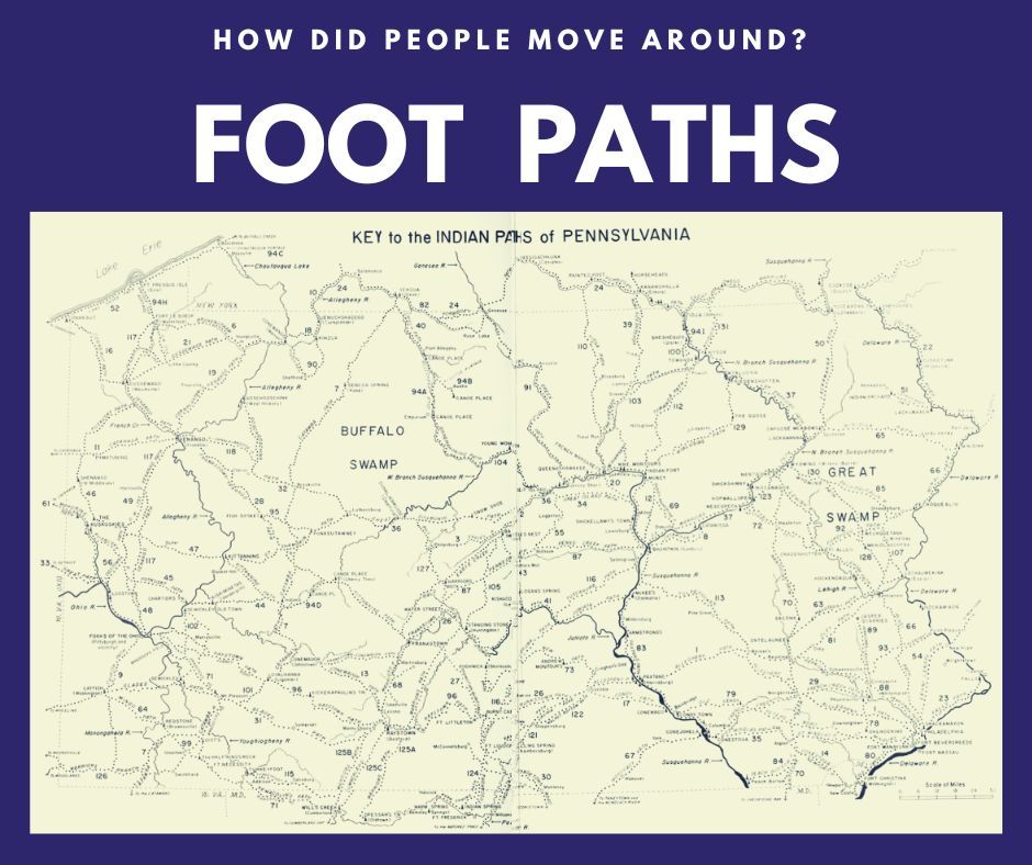
British General John Forbes in a letter to William Pitt of July 10, 1758, acknowledged the genius of the Indians “who have foot paths . . . through these deserts, by the help of which we make our roads.” The British widened the foot paths to move troops and supplies by wagon while fighting the French.
Researchers will find evidence of these Indigenous foot paths in the earliest land records kept at the PA State Archive. They were also compiled into the book Indian Paths of Pennsylvania, by Paul A. W. Wallace which includes helpful maps translated into driving directions.
Travel in 1820 to 1860
The early 19th century in Pennsylvania is notable for the development of natural resources for manufacturing. PA’s expansive hardwood forests were cut for furniture, iron deposits were mined for making stoves and guns, and farm products needed to get to cities. Wagons could not move these materials in large quantities. A new method of travel was needed.
In the days before powered engines, canals were the dominate way to move things. Moving raw materials and products via canals was efficient - heavy loads float easily, and canals are very reliable - they work in all weather and need little maintenance (unlike dirt roads). Everything could be piled onto a barge and pulled easily by a mule.
Canals were funded by both state government funds and local corporations. Most canals ran near rivers, either connecting them to each other or replacing them. The rivers in the very populated eastern half of the state - the Delaware, Susquehana, and Schuylkill Rivers - were shallow and fast-moving. Not ideal for travel by any size boat!
Many of our ancestors lived near these canals because it was how goods came in to their communities and resources went out. The importance of these canals for the few decades they were used is shown on this map at the Library of Congress.
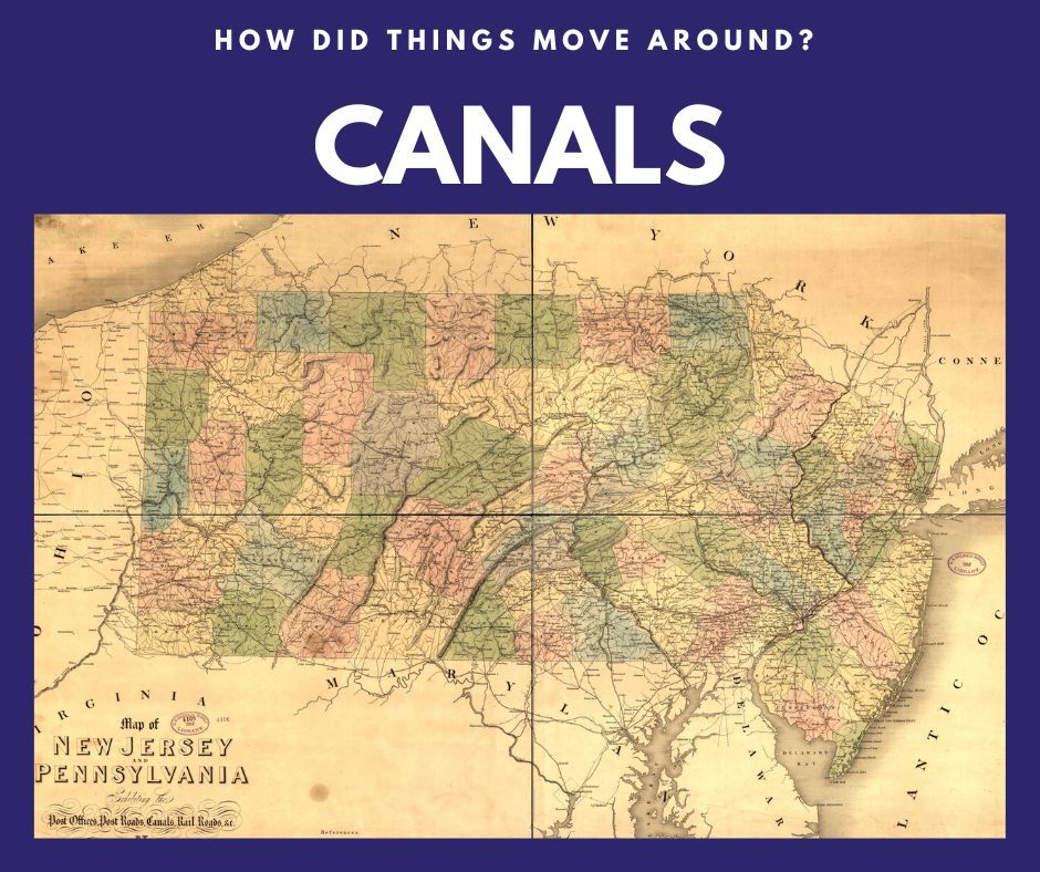
The canal network is clearly shown across Pennsylvania, tying together its largest cities. The PA Canal Society has short histories of these canals systems. The best resource is a local county history book which would detail the impact of canals on the local economy and people.
Travel in 1860 to 1950
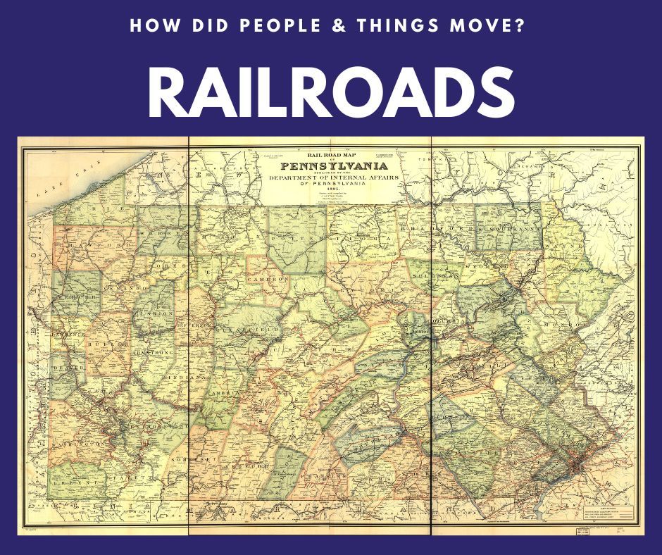
As great as canals were, they could not compete with what came next. The landmark invention of the 19th century was the steam-powered locomotive, aka “the iron horse”. Trains and railroads moved both people and products around the state at super speed. By 1860 thousands of miles of train tracks were laid each year. And by the 20th century, the Pennsylvania Rail Road dominated transportation.
A short history by a railroad fan helps to understand the impact of trains. This 1895 map made by the Pennsylvania state government shows how extensive the rail network was.
There was another form of travel also using steel tracks in this time period: electric trolleys. Trolleys provided cheap and easy transportation for everyone, both around and between cities. In the first half of the 20th century it was possible to travel across Pennsylvania switching from one-electric trolley to another. The Pennsylvania Trolley Museum near Pittsburgh has captured this history nicely.
Using Transportation in Genealogy Research
When trying to link people in one location to another, knowing the transportation method is vital.
Start by locating an ancestor using census, deed, or tax records. Using a map of the time period (plus the resources above), trace the foot paths, roads, canals, and rail lines in their area. Note where their transportation network goes - the towns and cities they connect to. Now check those networked locations with others on your family tree - are there cousins there? Parents? In-laws? Or did the ancestor relocate using that transportation path you found?
Connecting people by their travel routes can both prove relationships and open the way to new discoveries.
© 2019–2026 PA Ancestors L.L.C. and Denyse Allen. All Rights Reserved.
About PA Ancestors: The authoritative resource for Pennsylvania genealogy research — vital records, county courthouses, archives, probate, land records, military records, and immigration research across all 67 Pennsylvania counties. Founded by Denyse Allen, Pennsylvania genealogy researcher and author.
More Pennsylvania Research: paancestors.com